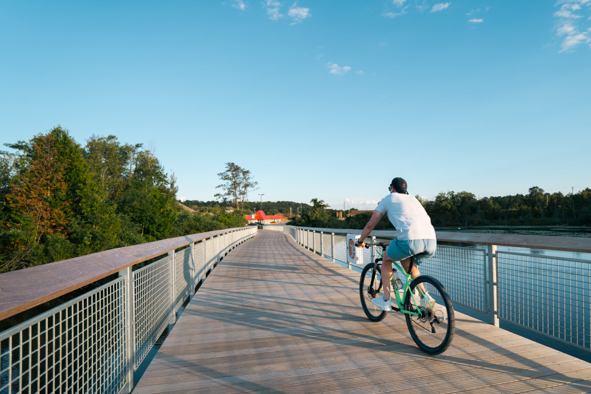
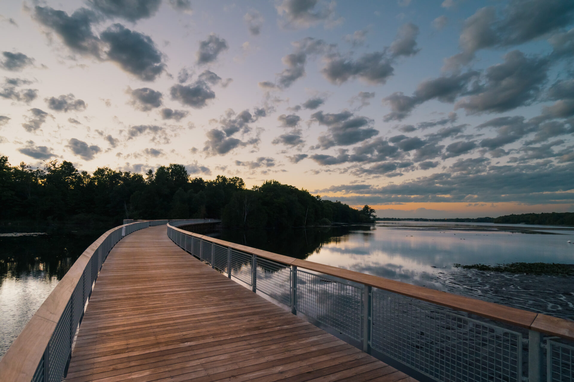

Boardman Lake Loop is a trail around Boardman Lake, just south of downtown Traverse City. The northern area of the trail offers an urban setting with commercial access, while the east side is a heavily wooded segment featuring gentle curves and a mix of pavement, boardwalk, overlooks, and gravel surfaces. The trail links users to community assets, including the library, a food market, Northwestern Michigan College University Center, densely populated neighborhoods in Traverse City and Garfield Township, and several commercial areas surrounding the lake.
The loop had a 1.6-mile-long gap to close. This section begins at 14th Street and meanders south to Medalie Park. In 2015, local leaders determined the completion of the trail needed to be a top priority for the Boardman Lake district. In response, Grand Traverse County applied for a Coastal Zone Management (CZM) grant from the MDNR to help fund the conceptual design phase of the project. Combined with additional funding from the Grand Traverse Brownfield Redevelopment Authority, work on the project began to take shape.
In conjunction with TART Trails, Garfield Township, and the City of Traverse City, Grand Traverse County hired Prein&Newhof to provide preliminary and geotechnical design, topographic surveying, mapping, assistance in public meetings, and design development drawings to finally close this long-awaited loop.
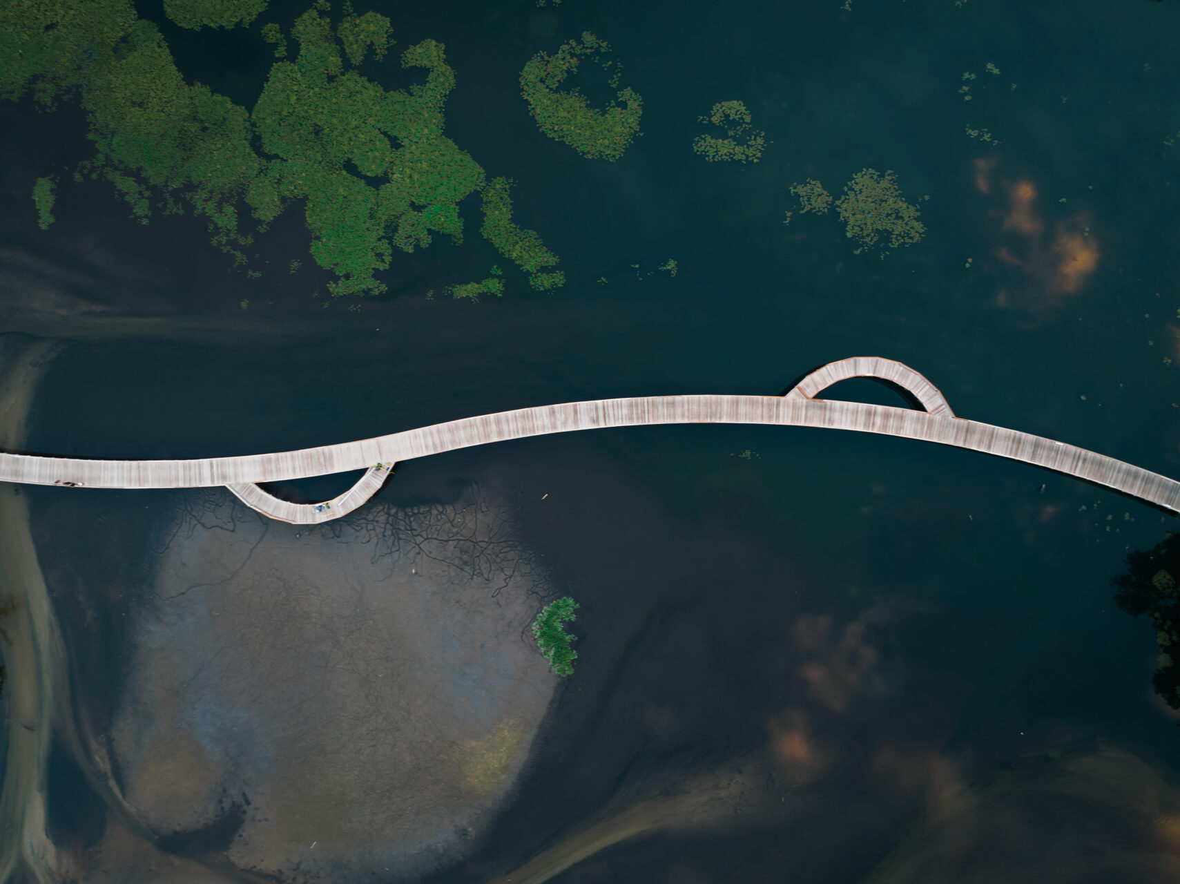
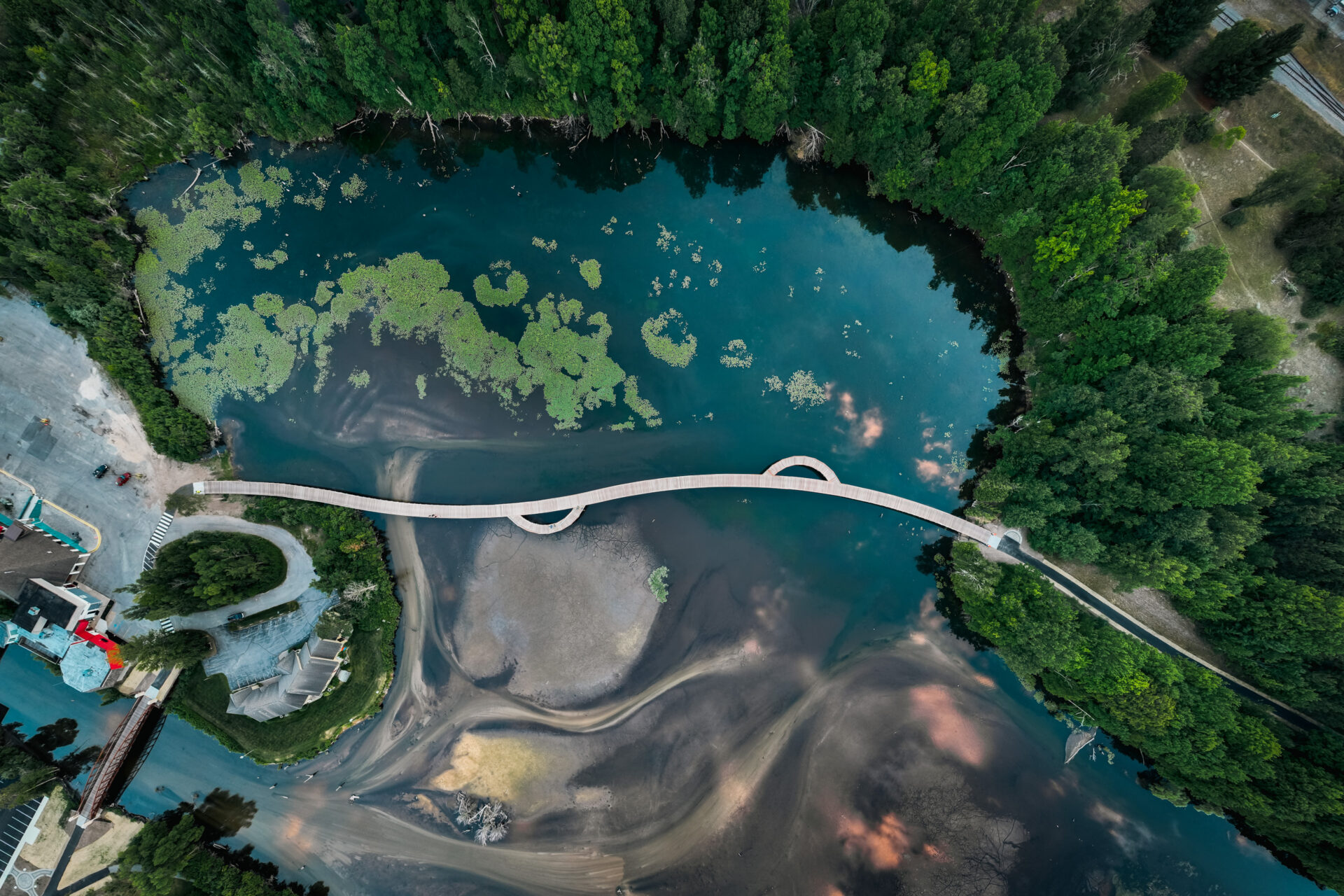
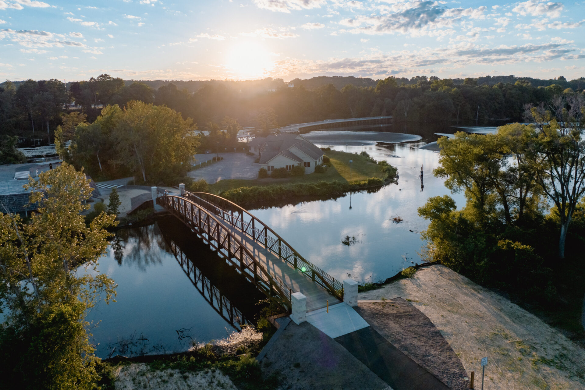
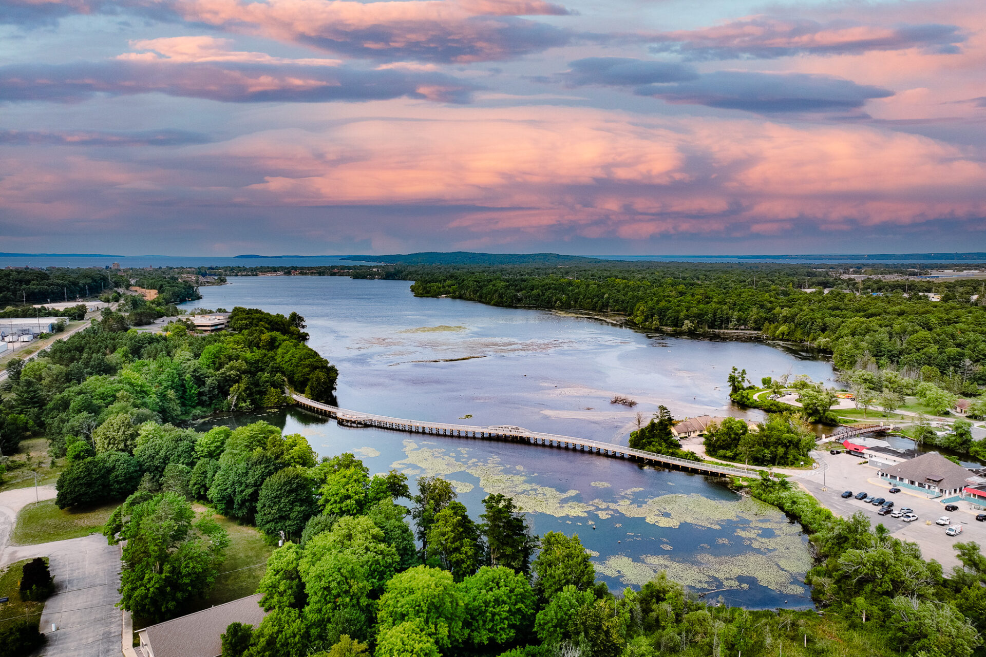
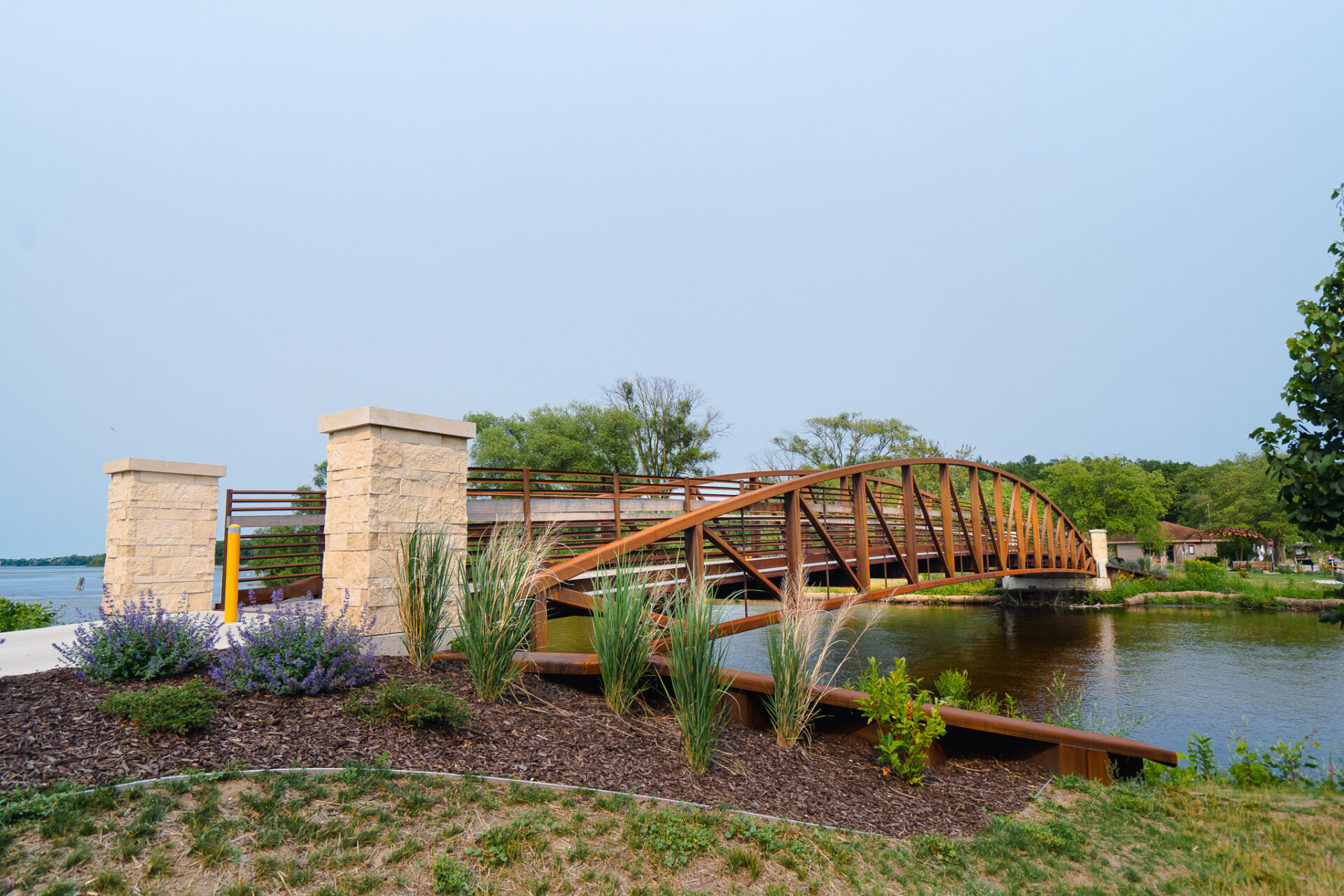
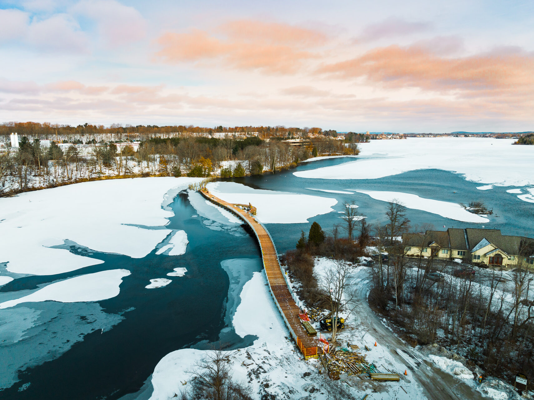
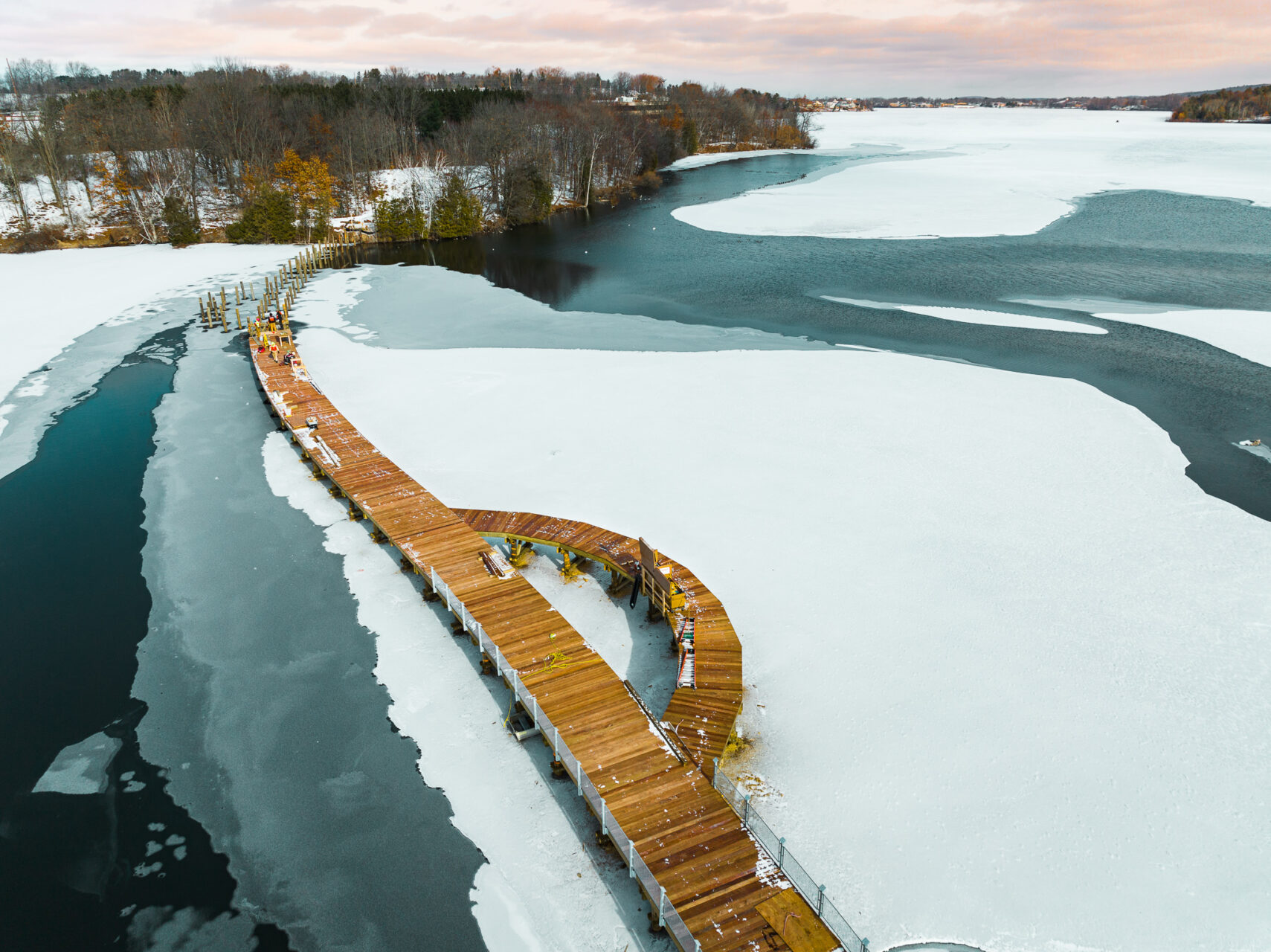
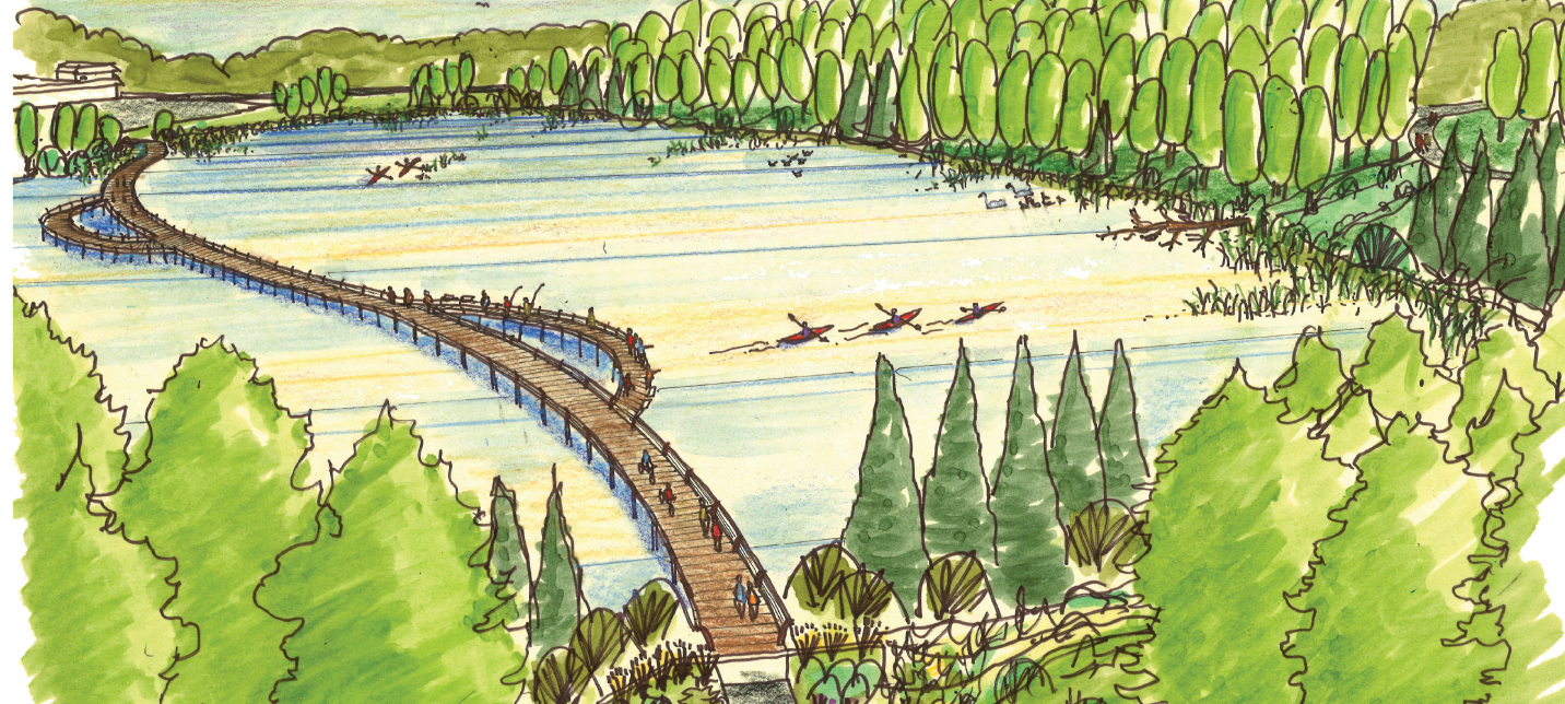
Details of the project included trail design and routing, boardwalk design over a shallow part of Boardman Lake, water access amenities including stairs and a fishing deck, and two bridges over the Boardman River to connect to the trail on the east side.
Working with multi-stakeholder team, meeting with the public many times, gathering input, and presenting the proposed design, everyone was enthusiastic about moving forward with the trail’s final leg. Phase 1, nearly a mile of the trail, included a retaining wall between 16th Street and Northwestern Michigan College University Center. The next leg of the trail, between Medalie Park and Northwestern Michigan College, included the big boardwalk, two bridges, and the overlooks.
Funding for the project included grants from the CZM program, MDOT’s TAP program, MDNRTF Passport program, and EGLE Brownfield funding. Garfield Township and Traverse City funded the remainder of the project.
From the time it took from initial planning to ribbon cutting—roughly 20 years—the 4.2-mile loop around Boardman Lake was finally completed in July of 2022. By all appearances since, it has been well worth the wait by the amount of traffic on the trail since it officially opened.
Stakeholder and Public Input
A stakeholder advisory committee was formed with organizations such as the Bay Area Transit Authority (BATA), Traverse City Light & Power, Northwestern Michigan College, Traverse Area District Library, the Disability Network of Northern Michigan, members from environmental groups, and the core Boardman Lake Loop leadership team to identify current programs, projects, activities or services on the trail’s use, design, or users’ experiences. This group met several times during the six months it took to complete schematic design. It also provided as a feedback loop on draft designs and ensured the concept was consistent with all parties’ expectations.
A series of community engagement group workshops were scheduled for community input and ideas to better understand the various needs and wants of the trail design from the public. These meetings were widely advertised and promoted to bring in a packed house at each session. Members of the Prein&Newhof design team and the core leadership team were present to facilitate discussion, brainstorm ideas, provide feedback, and answer questions. Overall, a very positive experience, and a significant amount of work was accomplished quickly.
Challenges
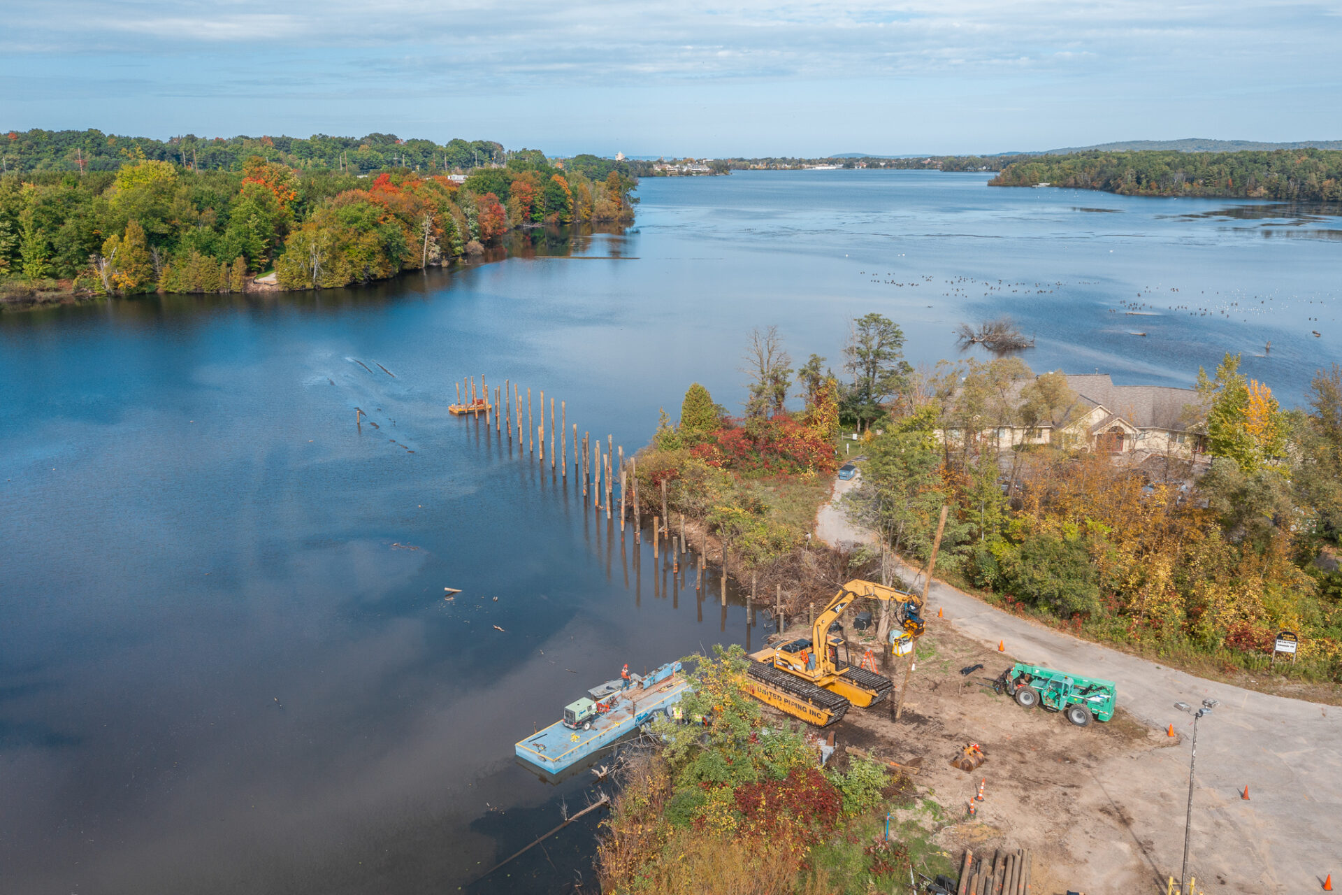
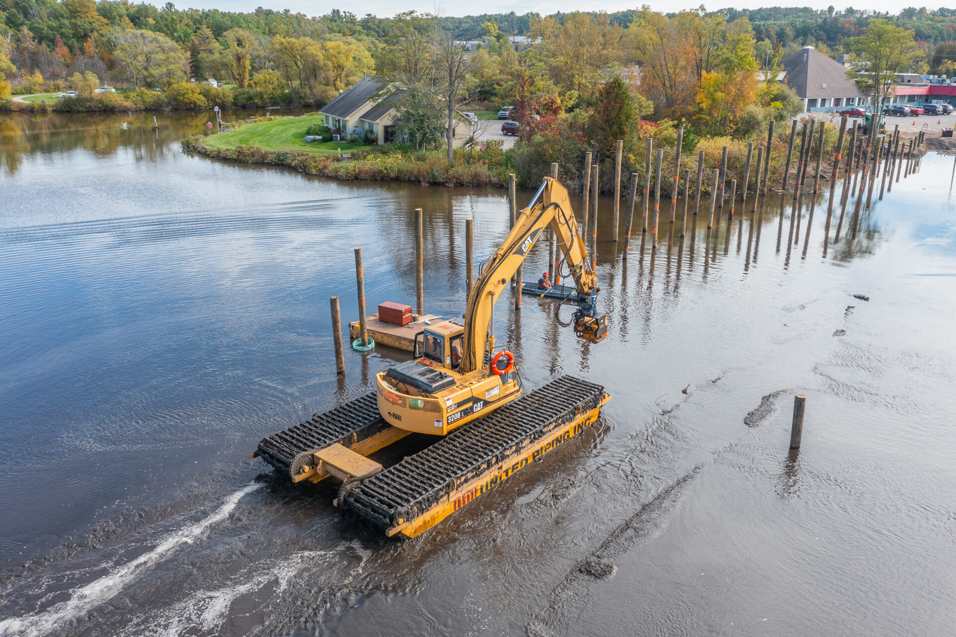
Weather was one of many challenges the construction crews faced. The area of the Boardman Lake where the boardwalk was to be located is shallow, and the lake bottom is full of organic peat materials. The equipment necessary to drive the piles needed to stay on top of this mess to do the work. Unfortunately, barges were not an option—not enough depth—therefore, it required a lot of innovation to craft a different solution: the swamp excavator.
The swamp excavator has wide tracks which serve as pontoons, so it can float. The contractor worked on the piles in both the summer and winter, using it to access pile locations out in the lake. An additional benefit was it allowed the crew to access the site without dredging, or using crane mats that would most likely have been lost in the mud or a barge.
Wood Pilings
GPS points provided by Prein&Newhof’s survey crew ensured precise locations for pile positioning in the middle of the lake making the process more efficient. The pile design length was 45 feet long and protruded 5 feet above the water to provide clearance under the boardwalk for kayakers. A vibratory pile driver was used to set the piles, and an impact hammer was used to finish the installation to ensure the pilings had the correct bearing capacity. In several locations a third pile was placed to obtain the required bearing capacity for the bent.
Team Elmer’s high level of professionalism was demonstrated by the expertise of their project management team.
Environmental Considerations
The bar for environmental considerations was substantially raised with the Boardman Lake Loop project. As a biodiverse habitat for many species indigenous to the region, great care was taken to protect not only the animals, birds, and reptiles but all of the plants and grasses along the banks and shoreline.
Area environmental groups were excited to be involved in the project, and members of their organizations were present and participated in the public meetings. Many of their suggestions were incorporated into the design of the project.
The original vision for this segment of the trail was to travel along the banks and shoreline, which would interfere with the wetlands and meadows in this area. During the planning phases, the design team recommended constructing a boardwalk to cross the Cove as a means to minimize the danger to wildlife. In addition to relieving the potential for wildlife distress, it would allow trail users to get an up close and personal perspective of wildlife without disrupting habitats.
The route of the boardwalk across the Cove significantly reduces any impact on the bird nesting area and shoreline wildlife, a big concern for all parties involved. Taking advantage of the excitement for the boardwalk concept, eyebrow overlooks were added to give a safe location for anyone taking the new nature and birdwatching opportunities that might otherwise be difficult to access with a large volume of traffic going across.
Emphasis was placed on shoreline restoration for the areas where the boardwalk and bridge abutments met the river or the lake. The trail was aligned and set at the boardwalk and bridges to minimize impact to the existing wetlands and meadows.
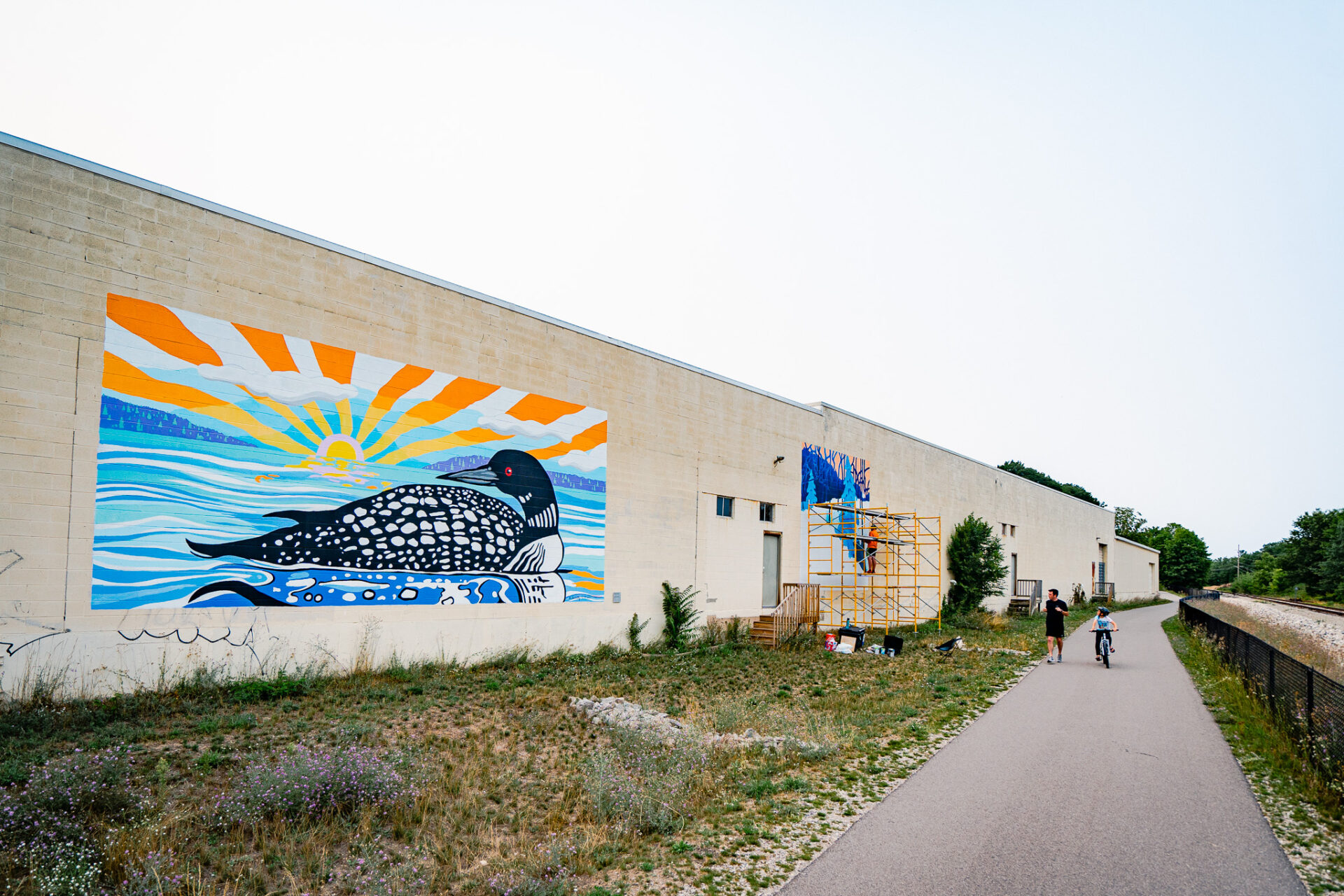
Native wetland plantings/shoots were specified to restore/recharge the existing wetlands at Medalie Park. Native grasses and plantings were planted along the trail, and a special native seed mix was developed to minimize washouts in very steep areas. The Brownfield areas were transformed to became more park like with new topsoil, grasses, and trees.