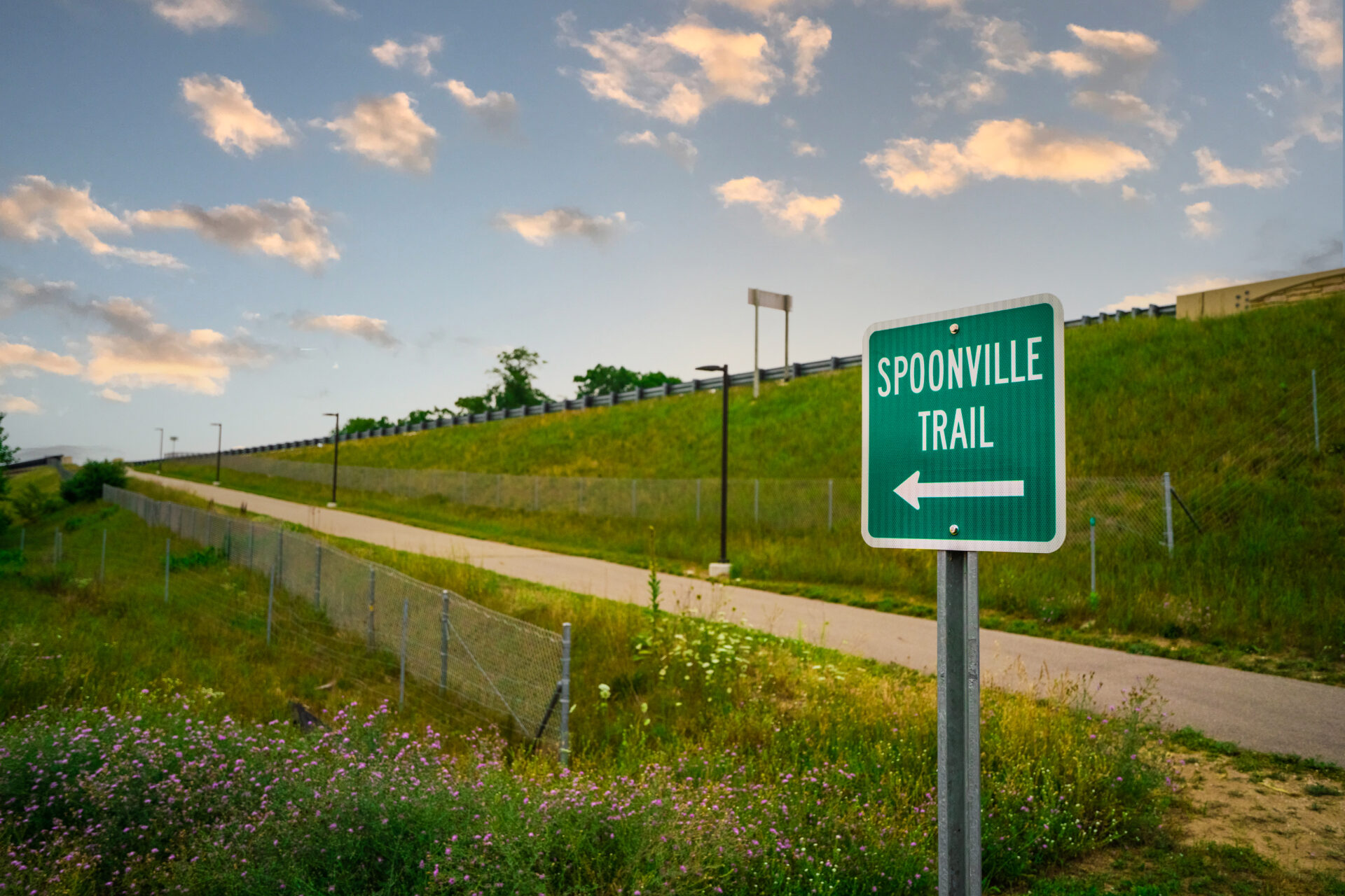
In 2015, Ottawa County began building a non–motorized pathway along 120th Avenue in Crockery Township. Coined as the Spoonville Trail in honor of the area’s history, this path’s purpose is to connect the north end of the North Bank Trail to the south end of the Idema Explorer’s Trail at the M–231 Trailhead. Spoonville Trail is part of a developing trail network that will span from Metro Grand Rapids to Lake Michigan.
Ottawa County hired Prein&Newhof for the site analysis and investigation, design development and cost estimating, permitting, construction document preparation, and construction administration of the trail.
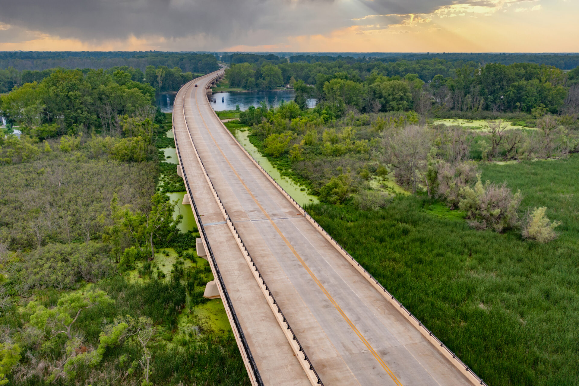
The County split the project into two phases to properly utilize project funding sources. Prein&Newhof designed both phases of the Spoonville Trail, incorporating local landmarks and monuments, such as the Sgt. Henry E. Plant Pathway on M–231 over the Grand River and the Crockery Creek Natural Area. Phase I involved 1.75 miles of paved trail, beginning at North Cedar Drive in Robinson Township and running north to Leonard Road in Crockery Township. MDOT provided the trail design for the portion of the trail that involved the M–231 Bridge. Construction of Phase I was completed in one summer, and the trail opened for public use in the fall of 2016.
Construction on Phase II began in 2020 with the goal of expanding the path an additional 1.75 miles from the intersection of Leonard Road and 120th Avenue to the north side of I–96 in Nunica, and connecting it with the North Bank Trail. A new 13–spot trailhead parking lot was also built on 120th Avenue, south of Arthur Street.
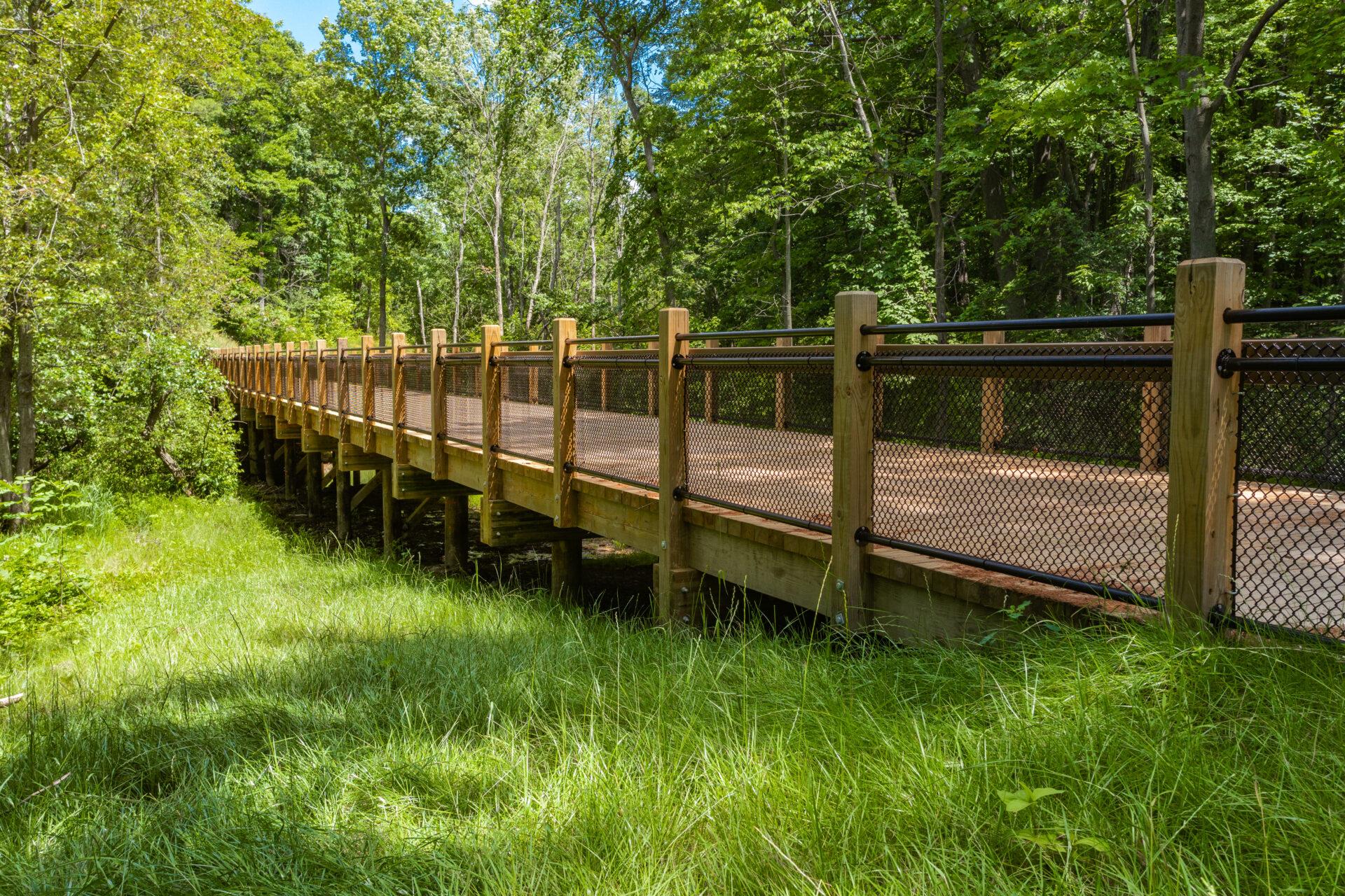
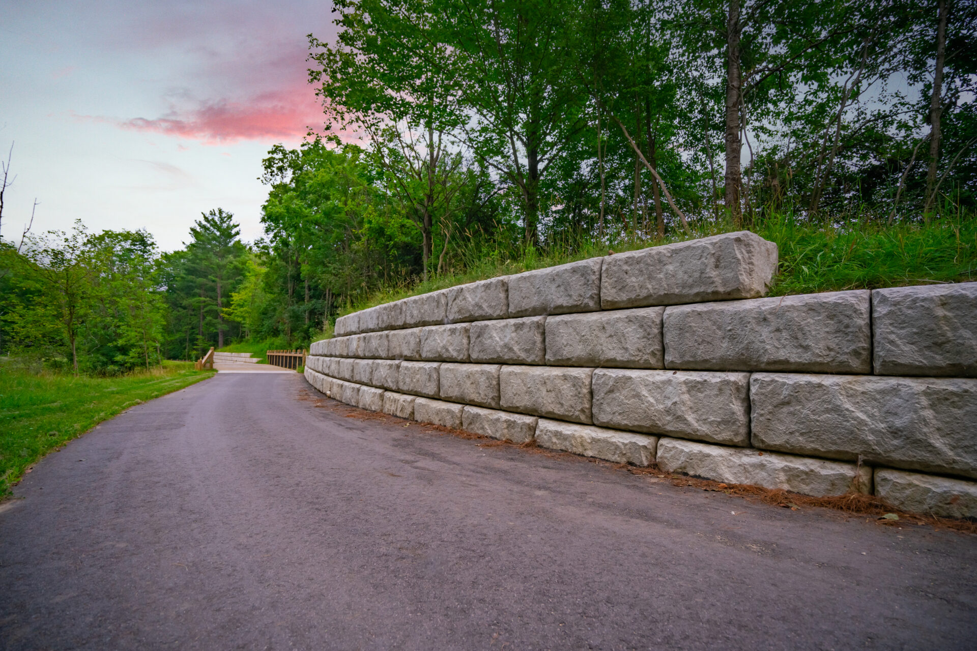
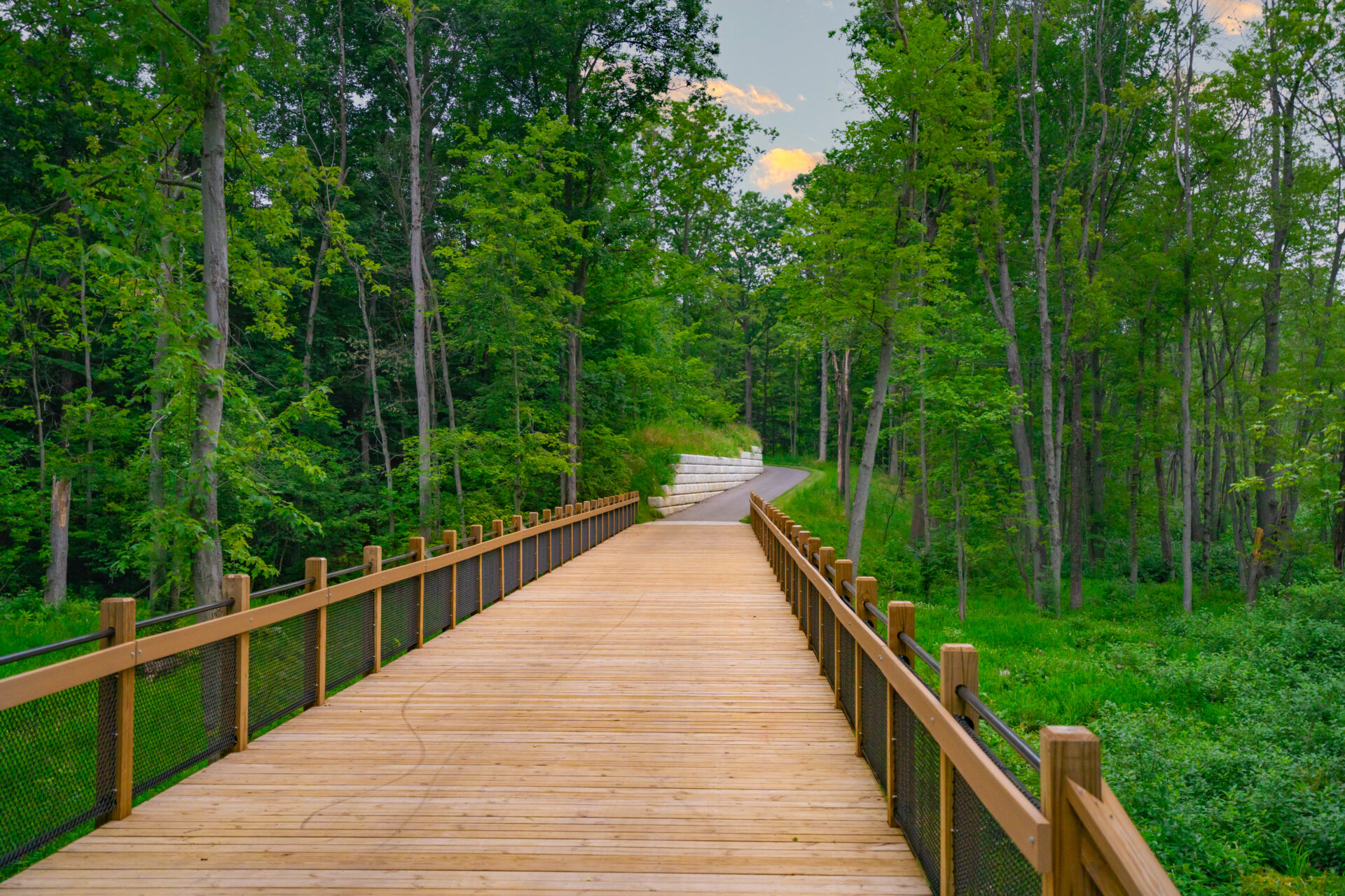
Developing the Spoonville Trail presented a few design challenges along the way. Prein&Newhof Project Manager Scott Post, PE explains just how challenging this scenic route was to design and construct, “For Phase II, Ottawa County chose to avoid merging the trail into the road right–of–way along Leonard Road and 112th Avenue. Instead, we designed the trail to run along the perimeter of Terra Verda Golf Course, creating a more beautiful user experience. To achieve this alternative route, we knew we had to meet ADA regulations within the deep ravines on the golf course. We also had to prevent soil erosion, decide where to land the boardwalks, obtain easements from property owners, and obtain right–of–way permits from the Michigan Department of Transportation (MDOT) because the design involved I–96, a federal highway.”
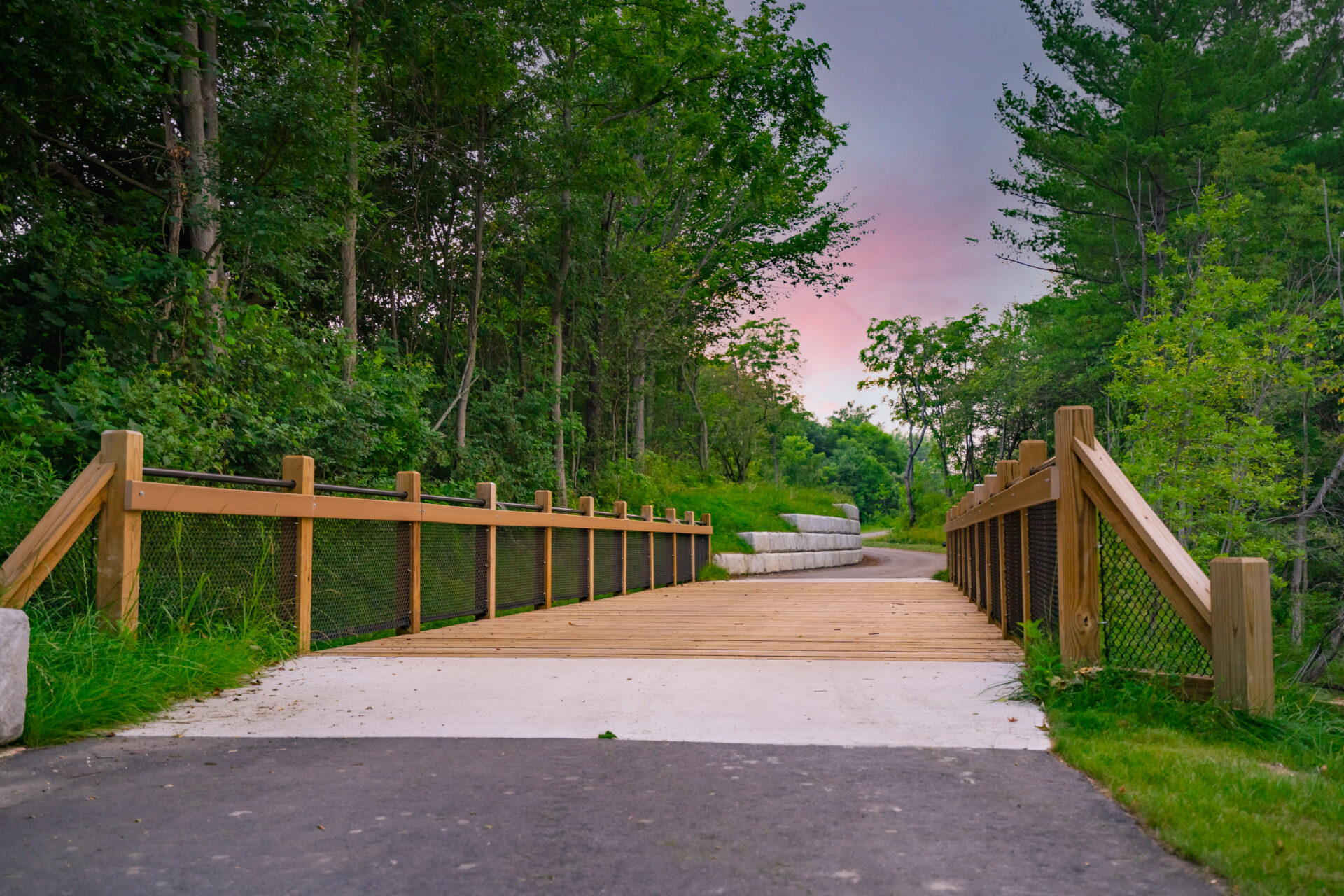
The construction of Phase II was complete in spring of 2021, allowing the public to now utilize the entire Spoonville Trail connector. The Spoonville Trail was designed to be 10 feet wide, with the boardwalks expanding to 14 feet wide. All five boardwalks in Phase II were built with a 20,000 lb. weightbearing limit. Within the ravines, there are six separate retaining walls, totaling 7,000 square feet. Prein&Newhof Landscape Architects Paul Reinhold, PLA and Matt Levandoski, PLA incorporated only native plant species into the design of the 120th Avenue parking lot, on Leonard Road, and at the intersection of 112th Avenue and I–96.